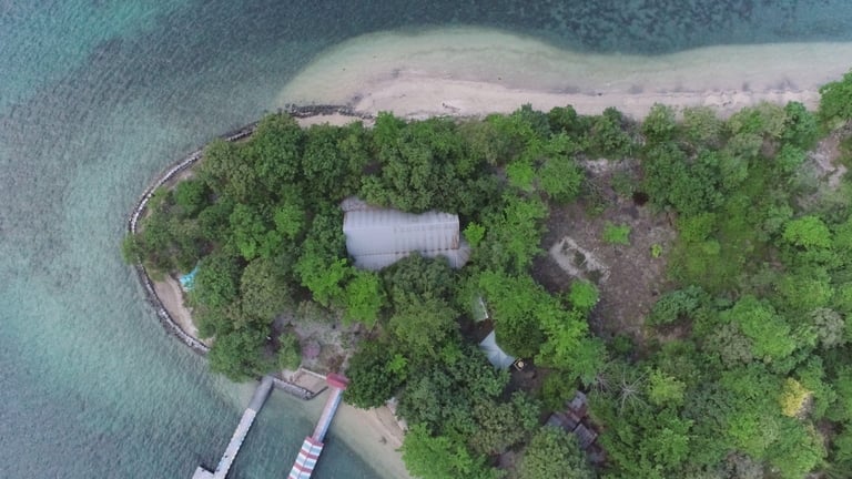
Kumo Island Experience: Ecology and Heritage
Step into the tranquil charm of Kumo Island, where rich mangrove forests meet calm coastal waters to create a sanctuary of ecological wonder. Nestled off the coast of Halmahera in North Maluku, Kumo stands as a vital node in the region’s coastal biodiversity. With its pristine landscape, the island offers more than scenic beauty; it serves as a living laboratory for ecological study and sustainable development.
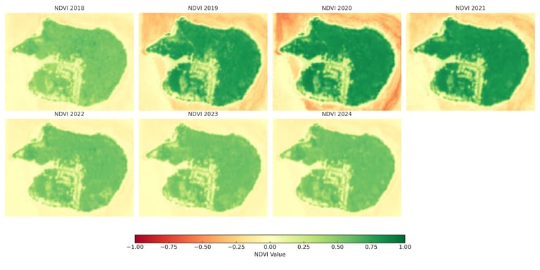
NDVI Monitoring (2018–2024)
The Normalized Difference Vegetation Index (NDVI) serves as a vital indicator of vegetative health and ecological balance. This temporal analysis highlights the spatial dynamics of greenness across Kumo Island from 2018 to 2024. Higher NDVI values (closer to green) indicate denser and healthier vegetation cover, while lower values (closer to red) suggest sparse or degraded vegetation.
📊 Key Observations:
2018–2019: Moderate and relatively uniform vegetation, with healthy coverage throughout the island’s core zones.
2020–2022: A notable decline in NDVI, particularly around the western and southeastern boundaries. This reduction may be attributed to climatic factors, shoreline degradation, or anthropogenic disturbances.
2023–2024: Gradual stabilization and improvement in NDVI, indicating possible natural regrowth, community-based restoration, or reduced stressors.
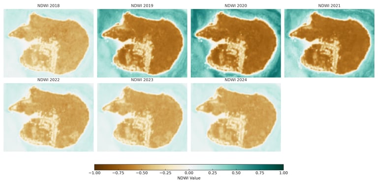
NDWI Monitoring (2018–2024)
The Normalized Difference Water Index (NDWI) highlights the presence of water bodies and surface moisture content. It is particularly useful for monitoring hydrological conditions across mangrove zones, wetlands, and coastal buffer systems. Temporal NDWI analysis on Kumo Island provides insight into the island’s hydrological fluctuations and their ecological implications.
📊 Key Observations:
2020–2021: Drier surface patterns are evident, particularly along coastal edges, aligning spatially with NDVI reductions—suggesting possible vegetation stress or seasonal desiccation events.
Post-2021: A gradual increase in surface moisture is noticeable, indicating potential hydrological recovery or the rewetting of areas previously subjected to dryness.
2023–2024: Consistent wetness across central and low-lying areas appears to stabilize, likely supporting conditions favorable for mangrove regeneration and ecosystem resilience.

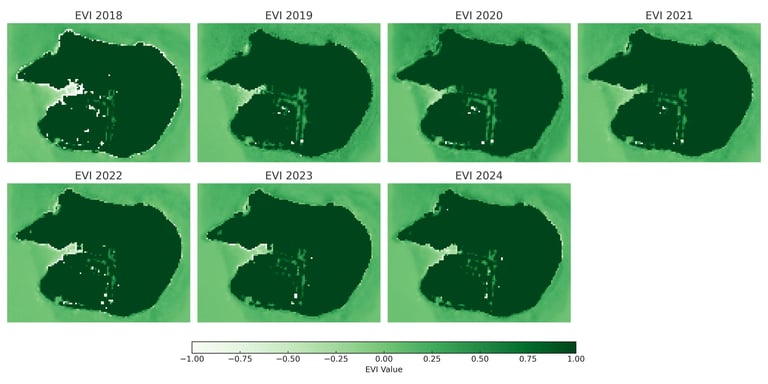
Enhanced Vegetation Index (EVI) provides refined insights into vegetation dynamics by correcting for canopy background and atmospheric influences. This index is especially useful in densely vegetated areas such as Kumo Island. The visualization reveals temporal fluctuations in vegetation health over a seven-year period:
📊 Key Observations:
2018–2019: Consistently high vegetation density across the island, with minimal fluctuations.
2020–2022: Moderate decline in vegetation intensity, particularly in southern coastal zones, potentially due to stress events or seasonal impacts.
2023–2024: Marked improvement in EVI values, indicating regrowth and ecological resilience, especially in central and eastern areas.
EVI Monitoring (2018–2024)
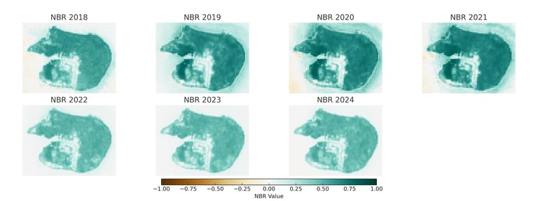
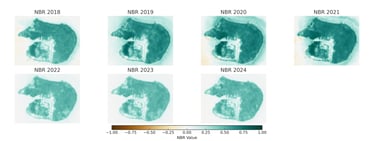
Normalized Burn Ratio (NBR) is a spectral index designed to detect burned areas, post-fire regrowth, and vegetation stress. It is especially effective in monitoring ecological disturbances and recovery in coastal and forested ecosystems such as Kumo Island. The visualization illustrates temporal variations in NBR values over seven years.
📊 Key Observations:
2018–2019: Stable NBR values across most regions, indicating minimal disturbance or fire-related stress.
2020–2022: Marked decline in NBR values, especially in central and southern parts of the island, possibly reflecting vegetation degradation, hydrological changes, or anthropogenic pressure.
2023–2024: Observable improvement in NBR values, suggesting early signs of ecological recovery and stabilization, particularly around mangrove fringes and interior lowland zones.
NBR Monitoring (2018–2024)
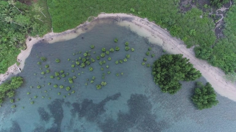
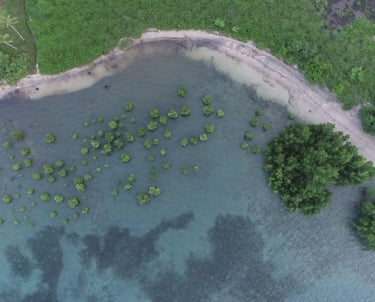
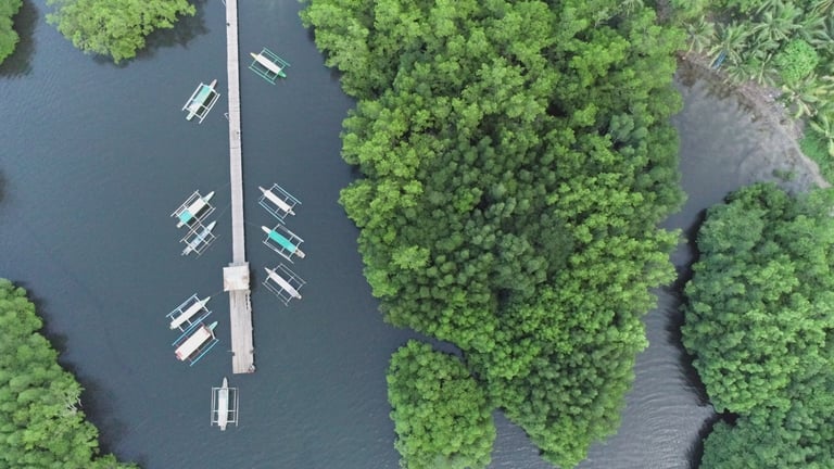
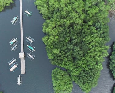
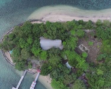
Ground Verification using Aerial Drone Videography